Apologies for the poor quality of these maps. They will be replaced when better quality maps are derived.
Alverdiscott Boundary Map
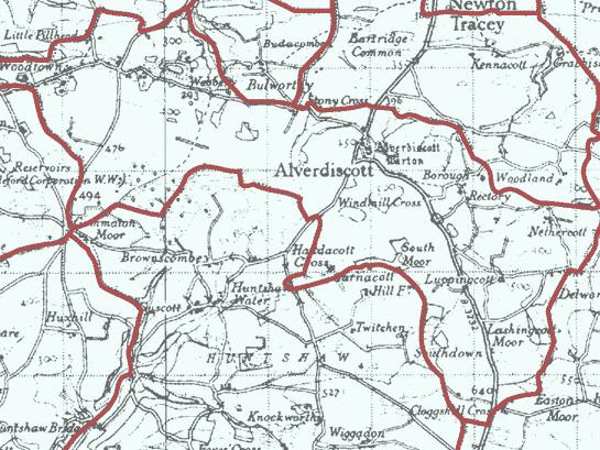
Parish: Alverdiscott: All Saints
| Deprivation rank (1=most deprived, 12,425=least deprived) | 3,873 |
| Parish population | 313 |
| Parish number of occupied households | 113 |
| Area (square miles) | 4.0 |
| Population density (people per square mile) | 78 |
| % aged 0-4 | 3.8 |
| % aged 5-17 | 10.6 |
| % aged 18-29 | 11.6 |
| % aged 30-44 | 15.6 |
| % aged 45-64 | 35.5 |
| % aged 65 and over | 22.9 |
| % White ethnicity | 99.5 |
| % Asian ethnicity | 0.0 |
| % Black ethnicity | 0.0 |
| % Mixed ethnicity | 0.4 |
| % Other ethnicity | 0.0 |
| % Christian | 68.8 |
| % Buddhist | 0.0 |
| % Hindu | 0.0 |
| % Jewish | 0.3 |
| % Muslim | 0.0 |
| % Sikh | 0.0 |
| % Other religion | 0.0 |
| % No religion | 23.9 |
| % Religion not stated | 7.0 |
| Parish Code | 150518 |
| Parish local name | Alverdiscott: All Saints |
| Parish legal name | Alverdiscott |
Huntshaw Boundary Map
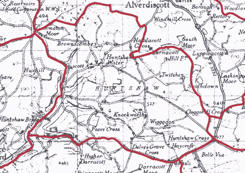
Parish: Huntshaw: St Mary Magdalene
| Deprivation rank (1=most deprived, 12,425=least deprived) | 3,794 |
| Parish population | 133 |
| Parish number of occupied households | 56 |
| Area (square miles) | 3.3 |
| Population density (people per square mile) | 41 |
| % aged 0-4 | 3.0 |
| % aged 5-17 | 12.7 |
| % aged 18-29 | 8.3 |
| % aged 30-44 | 11.3 |
| % aged 45-64 | 43.1 |
| % aged 65 and over | 21.5 |
| % White ethnicity | 97.8 |
| % Asian ethnicity | 0.0 |
| % Black ethnicity | 0.0 |
| % Mixed ethnicity | 2.2 |
| % Other ethnicity | 0.0 |
| % Christian | 62.7 |
| % Buddhist | 0.0 |
| % Hindu | 0.0 |
| % Jewish | 0.0 |
| % Muslim | 0.0 |
| % Sikh | 0.0 |
| % Other religion | 0.0 |
| % No religion | 34.2 |
| % Religion not stated | 3.1 |
| Parish Code | 150527 |
| Parish local name | Huntshaw: St Mary Magdalene |
| Parish legal name | Huntshaw |
All parish statistics and metrics derived from Arcgis.com.
More information on parish maps on Arcgis.com is available here (follow this link).
Census statistics are from 2011 and deprivation statistics are from 2015.